image of Hrabanus Maurus

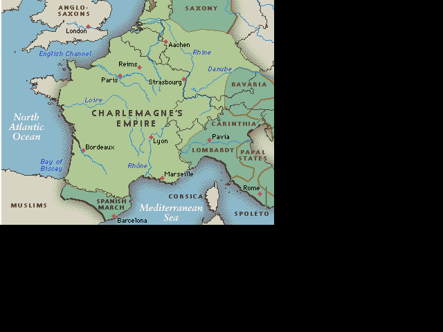
Week 7: Hrabanus Maurus: De rerum naturis.

Background | Background Quiz | Starting Assumptions | Resources | Extras
Vocabulary | Etymology | Grammar | Perseus Dictionary | Perseus Tool

Reading Overview | Reading Quiz: English
| Reading Quiz: Latin
Discussion Questions | Latin Composition | Weekly Checklist


Map of Charlemagne's Territories

map of Charlemagne's empire

The Light Green areas were lands held by Charlemagne in 771. The Dark Green are lands acquired by Charlemagne by 800.

(map found at http://pages.prodigy.com/charlemagne/)

Mainz, where Hrabanus was born and where he died, is located on the Rhine river, just west of Frankfurt

Fulda is located in central Germany, in the Fulda River valley (it is about 100 kilometers east of Frankfurt).

You can see both of these cities more clearly in the map below, which shows the division of Charlemagne's kingdom after his death, beginning with the treaty of Verdun in 843.

map of Verdun Treaty


Modern Languages 4970 / MRS 4903: Medieval Latin. Spring 2003 Online Course at the University of Oklahoma. Visit http://www.ou.edu/online/ for more info.
Laura Gibbs, University of Oklahoma - Information Technology © 2003.  laura-gibbs@ou.edu. Last updated: December 29, 2002 7:12 PM